
SurveySense — Every Traffic Survey Type, One AI-Powered Platform
Traditional traffic surveys mean manual counters standing at junctions with clickers, for a few hours, on one day — a snapshot treated as if it represents every day. SurveySense replaces that with camera-based AI counting across whatever survey type the study calls for: longer duration, full classification, consistent methodology, no counter fatigue.
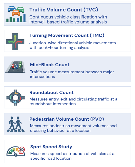
Eleven Survey Types, One Platform
Each survey type answers a different planning or enforcement question — pick the study, not a one-size-fits-all count.
Classified Volume Count
Mid-block volume by vehicle class — the foundation dataset for planning and pavement design
Learn more →Turning Movement Count
Every movement at a junction, by approach — the core input for signal timing and capacity design
Learn more →Spot Speed Studies
Speed distribution at a point — the standard basis for setting limits and siting enforcement
Learn more →Origin-Destination Surveys
Where trips start and end — foundational data for corridor and bypass planning
Saturation Flow Studies
Maximum sustainable flow at a junction approach — key input for signal-cycle design
Pedestrian Count Studies
Pedestrian volume at crossings — justifies signals, footbridges, and crossing priority
Parking Occupancy Studies
On- and off-street utilization over time — informs parking policy and enforcement
Before-After Studies
Measures the actual impact of a completed intervention against baseline conditions
Average Speed Study
Measures average travel speed and travel time along a corridor — distinct from spot speed, which measures at a single point
Traffic Conflict Analysis
Identifies and analyses near-miss traffic conflicts for proactive safety assessment
Learn more →Lane Change Study
Measures lane-changing behaviour and frequency on multi-lane roads
How It Works
01
Point a Camera
A single camera per approach or vantage point — no multiple counters standing in traffic for hours.
02
DAIOS Classifies & Counts
AI runs continuously, classifying vehicles or pedestrians by type and movement, for as long as the study needs.
03
Deliverable-Ready Data
Structured output matched to the survey type's standard deliverable — no manual tallying or transcription.
Getting Survey-Grade Footage
Good counts start with good video. These are the setup guidelines our team recommends for survey cameras. They are field practice, not hard requirements, and we review every site plan with you before recording starts.
Mounting height
6–12 m on urban roads; 8–15 m on highways.
Viewing angle
20–45° to the direction of traffic. Avoid head-on views.
Lanes per camera
3–5 lanes per camera for reliable classification.
Resolution
1080p for volume and basic classification; 4K for detailed multi-class or axle-level studies.
Frame rate
25–30 frames per second.
Sun and lighting
Avoid pointing into the rising or setting sun. Check night lighting for 24-hour counts.
Planning a multi-site programme? Talk to us about a site-survey checklist for your field teams.
Built for Real-World Survey Conditions
Offline Video Analytics
Analyze pre-recorded MP4 footage — ideal for remote locations or sites without live connectivity
Single & Multi-Lane Support
Accurate counting across single-lane, multi-lane, and lane-less road environments
Wide Vehicle Class Coverage
Two-wheelers through multi-axle trucks, tractors, and special vehicles
Turning Movement & Directional Analysis
Left, through, and right-turn counts for junction-level analysis
DPR-Ready, IRC-Aligned Report Formats
Classification matrices, hourly/daily reports and CVPD/ADT/AADT outputs in IRC-aligned (self-declared) formats, ready for consultant and authority review
Raw & Processed Data Exports
CSV and Excel exports for independent analysis and validation
Easy-to-Use Dashboards
Visual traffic trends and composition — no complex learning curve
Scales Across Locations
Manage a single junction survey or many sites under one platform
Consistent & Reliable Accuracy
Removes fatigue, counting errors, and observer bias common in manual surveys
Data Traceability & Audit Timeline
Every upload, analysis, and report is timestamped and linked to the exact moment in the source video — fully verifiable and audit-ready.
SurveySense supports all standard vehicle classifications used in traffic surveys, with the flexibility to add or customize classes per project requirements.

Business Impact for Survey Businesses
How SurveySense changes the numbers that matter most to your survey business.
Improve Margins
Lower cost per survey — AI replaces hours of analyst time per video, directly improving margin per project.
Scale With a Small Team
Take on more concurrent surveys with the same team. Revenue scales; headcount and costs don't.
Win More Bids
Present modern AI capability in tenders — demonstrate faster turnaround and higher accuracy than traditional methods.
Future-Ready Platform
SurveySense data feeds ITS, adaptive signal systems, and smart mobility infrastructure planning.
For Traffic Survey & Consulting Agencies
Already run manual traffic counts or survey contracts? SurveySense is available as a white-label AI layer for survey agencies and transportation consultants — not a competitor, a way to deliver more studies, faster, without adding headcount.
Partner With Us →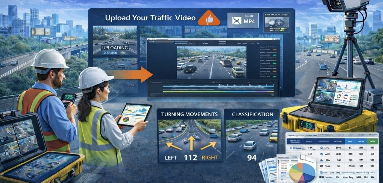

Frequently asked questions
Which traffic surveys does SurveySense support?
Eleven study types: classified volume count, turning movement count, spot speed, origin-destination, saturation flow, pedestrian count, parking occupancy, before-after, average speed, traffic conflict analysis and lane change studies.
How does SurveySense ensure accuracy?
Counts come from recorded video rather than live manual observation. AI detects, tracks and classifies every vehicle with the same logic across every location and survey day, and every count stays traceable to its source video.
Can survey data be validated later?
Yes. Every count and classification links back to the exact moment in the source video, so consultants and reviewers can check any figure during technical review, audits or disputes.
What outputs do we receive?
Structured reports for DPRs and studies (classification matrices, hourly and daily summaries, peak-hour analysis, CVPD/ADT/AADT), tabular datasets for modelling, and charts for presentations. All outputs are organised by location, date and survey type.
Are the reports suitable for government and DPR work?
Reports follow IRC-aligned (self-declared) formats and are validation-ready, so they fit DPR preparation, technical scrutiny and authority review.
Can SurveySense handle multi-location, multi-day or long-duration surveys?
Yes. A single project can cover many locations, directions and survey days with a consistent data structure. Long recordings are processed without extra manual effort.
How quickly are results available?
Much faster than manual counting. Once videos are uploaded, analysis, charts and reports are generated automatically; turnaround depends on the volume and duration of footage.
Can our survey agency use SurveySense under our own brand?
Yes. Survey agencies can use SurveySense as a white-label platform: your team records the video, the platform does the counting and classification, and you deliver the reports to your clients under your brand.