
RoadSense — Road Condition Assessment, From Drive to Dashboard
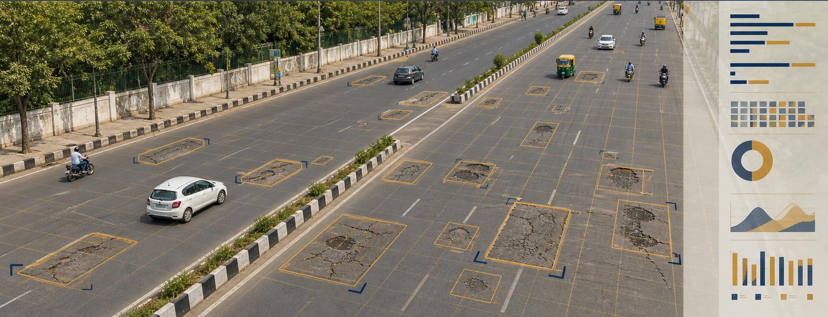
Every monsoon brings fresh road damage, mounting public complaints, and — as courts and regulators hold road authorities increasingly accountable for road safety — real liability exposure for road authorities. RoadSense turns a simple dashcam-equipped drive into a complete, geo-tagged road condition and safety audit. No specialized survey vehicles. No weeks of manual fieldwork.
90%+
Detection Accuracy (self-declared)
60+
Road Parameters
IRC-Aligned
Self-Declared Standard
Core Platform Components
Video-Based Survey System
Dashcam-equipped vehicles capture geo-tagged, timestamped footage across the full road network, with day and night capability.
DAIOS AI Detection Engine
Computer vision models process every frame to detect and classify 60+ road parameters with contextual severity grading.
GIS Intelligence Dashboard
Cloud-based platform with colour-coded condition maps, authority-wise road segregation, and drill-down to geo-tagged imagery.
Predictive Maintenance Engine
Trend analysis and condition-score forecasting enable proactive budget planning and priority maintenance queues.
Everything a Road Authority Needs
RoadSense integrates survey operations, AI intelligence, GIS mapping, automated workflows, and predictive analytics into a single platform.
GIS Command Dashboard
An interactive, map-centric interface giving every stakeholder — from field engineers to commissioners — road intelligence at the right level of detail.
Digital Road Register & Asset Inventory
A structured, searchable database of every road segment and roadside asset — replacing paper registers and spreadsheets.
Alert, Work Order & Escalation System
Complete defect lifecycle management, from detection to verified closure, with a full audit trail at every step.
Predictive Maintenance & Analytics
Forecasts road deterioration and prioritizes maintenance spend for maximum impact.
Configurable Rules Engine
Every assessment parameter, SLA timeline, alert rule, and dashboard view is configurable to match your authority's operational requirements.
Reporting & Compliance Outputs
Structured report types covering every stakeholder need — from field engineers to commissioners and audit bodies — in government-ready formats.
Standardized Road Condition Index (RCI)
Computes segment-level condition scores for uniform grading, comparison, and data-driven maintenance prioritization.
Highway & Corridor Intelligence
Chainage-based mapping, corridor monitoring, and contractor performance evaluation for highway networks.
Secure Governance & Access Control
Role-based access, encryption, and audit logging for secure, compliant system usage.
As courts and regulators increasingly treat safe roads as a duty owed to every road user, road authorities carry a real duty of care. RoadSense gives you the geo-tagged audit trail before a defect becomes a liability — not after.
What RoadSense Detects — By Category
60+ road parameters, organized by category — illustrative examples below, not an exhaustive list.
Pavement Condition
Potholes, cracks, rutting, surface wear
Structural Integrity
Edge damage, shoulder drop, settlement
Road Safety
Road markings, delineators, reflectors
Traffic Infrastructure
Signboards, street lights, signals
Barriers & Protection
Guardrails, crash barriers, medians
Drainage & Utilities
Water stagnation, drain covers, manholes
Encroachments
Illegal parking, roadside encroachments, unauthorized access
Environment & Cleanliness
Debris, vegetation, obstructions
"Recently used to audit a 60 km urban corridor ahead of a major public event."
11,000+ road assets geo-tagged · 870 safety findings · delivered within one week
For Road Survey & Inspection Agencies
Already run manual road surveys or inspection contracts? RoadSense is available as a white-label AI layer for survey agencies — not a competitor, a force multiplier for the work you already do.
Partner With Us →Learn More
Go deeper on how AI-based road assessment actually works, and how it holds up against statutory audit requirements.
Frequently asked questions
How does a RoadSense survey work?
A vehicle fitted with a dashcam drives the road network and captures geo-tagged, time-stamped video, by day or night. The DAIOS AI engine processes every frame, detects and grades defects and assets, and publishes the results to a GIS dashboard. You get a map of the whole network with each finding linked to its location and image.
What does RoadSense detect?
More than 60 road parameters across eight categories: pavement condition, structural integrity, road safety features, traffic infrastructure, barriers and protection, drainage and utilities, encroachments, and environment and cleanliness. Examples include potholes, cracks, rutting, faded markings, damaged signboards, broken guardrails, water stagnation and roadside obstructions.
How accurate is RoadSense?
RoadSense delivers 90%+ detection accuracy (self-declared). Each finding is linked to its geo-tagged image, so your engineers can verify any detection before acting on it.
Does RoadSense follow IRC standards?
RoadSense outputs are IRC-aligned (self-declared): defect categories, severity grading and reports are structured to match the way Indian road authorities assess and report road condition.
How quickly can a pilot start?
How quickly a RoadSense pilot can start depends on scope. A pilot covers setup, a survey run on your selected roads, and dashboard access for your team.
What happens after a defect is detected?
Each defect can become a work order with an owner, an SLA and escalation rules. The system tracks it from detection to verified closure, with a full audit trail, so you can show what was found, who acted, and when it was fixed.
Where is our data stored, and who can see it?
RoadSense runs on DAIOS, which can be deployed fully on-premises or on cloud infrastructure of your choice. Access is role-based, data is encrypted, and every action is logged.
We are a survey agency. Can we offer RoadSense under our own brand?
Yes. RoadSense is available to survey and engineering agencies as a white-label platform, so you can deliver AI-based road assessments to your clients under your own brand. Talk to our partnerships team to discuss the programme.